Stories Covering " Bridges "
Showing posts with label Bridges. Show all posts
Stories of town explorations.
"I think it is safe enough to tell that I am not overrating the bridge because as I see people passing through the bridge, they too, stand amazed."

It was a motorbike stroll to Caoayan, a very small town south of the city of Vigan. My target is to see the Caoayan Bridge. I don't have any idea how it looks like but just because the RHU Physician of the said town suggested that I have to see it and photograph it, I waited for the sun to go down to finally see what the RHU doctor was telling me.

A Grand Entrance!

Caoayan Bridge was undoubtedly stunning.


The road I have to take while driving the scooter was not as bright as the scene I saw in the town. So upon making a left turn going to Caoayan poblacion, the boring night turned magical!

I can't resist my self to ride off the scooter and to just park it along the bridge and decide to just walk and enjoy the magic of the dark night!

The lights of the bridge made the dark night so bright.


It was indeed a grand entrance to the town. The ordinary bridge becomes extraordinary at night. Even some motorists and vehicle owners driving to Caoayan can't help but be amazed and to get off their rides and cars to take photos.

Quick Walking Tour


The inviting bridge has made me decide to just walk.


I think it is safe enough to tell that I am not overrating the bridge because as I see people passing through the bridge, they too, stand amazed. They get off their rides and take a photo while staying for a while to feel the magic it brings.

Caoayan Town Hall

Caoayan Town Hall (Sorry for the wrong photo label)


I have crossed the bridge and the scooter-stroll-turned-walking-tour lead me to the Caoayan Municipal Hall. The town poblacion was really quiet. Some barbecue stalls around are still open. I was glad to see that a big investment has come to town when I saw a super-mart chain standing at the middle of the small town.

The municipal hall has been finished too! It's been a while since the last time I visited this town. The once small, old and not-so-good-looking municipal hall has transformed to a beautiful building!

Light reflections in my scooter's side mirror


It's nice to be back here. I discovered it has something new to offer aside from the popular barbecue stalls that are attracting foodies from the town and nearby towns.

The quick night walking tour in town was a quick reminder that I don't need to ride an airplane just to see great places because some of the great places are just actually near you.
NAGUSTUAM DIAY NABASAM/NAKITAM? MABALIN MO MET I-LIKE.
Stories of town explorations.
"I have to say you need to experience first before concluding and I found out that people at the remote barrios are warm, accommodating and kind."

Seeing a hanging bridge over a great river, well, over a creek will do too, has always been a fascination whenever I travel. I said it is a fascination because I rarely see a hanging bridge since I am a [component] old city dweller wherein what I see everyday are >100-year-old houses and multi-century-old structures, parks and palace. Looking at individuals crossing different types of hanging bridges sparks a different kind of feeling in me. At last, there is something "new" in my sight, not really the old thing I am already used of seeing daily.

Overview

Ambalayat Hanging Bridge
Hmmm, I am very much confident to say that the town of Tagudin should be a must-experience destination when it comes to HisTourism (History + Tourism) because unknown to many, major events in our history which are actually 'firsts' happened here. I will talk more about this for the next posts.

Aside from historical sites in the town, just in case you are already tired of bombarding your brain with thoughts that will compel you to invent a time machine just to be able to understand history and/or going back to school to stare for 1 hour for that boring history teacher, then I can suggest a place for you that is not related to Persian Gulf Wars, rocket science and Ming dynasty.

Location of Tagudin on Map

The people call this as Ambalayat Hanging Bridge, some also call it Ambalayat Foot Bridge. But it is more popularly called as a hanging bridge maybe because motorcycles can also cross the river using this bridge and not merely by foot. (#edmareasoning)

It is located in Brgy Ambalayat, hence the name, the last frontier of Tagudin town at the east. Ambalayat hanging bridge connects this remote barangay to the rest of [mainland] Tagudin. The barrio is being detached from the main landmass of Tagudin because of the Amburayan River that separates it. So don't think this is an island the moment I said that it is detached from the mainland.

It is actually located at the parts of Tagudin wherein mountains start to appear closer and going further at the east would be another mountain town already.

The Little (or more) pain of Going

Road to aAmbalayat
I am sharing this to show you how to go there and to encourage you to think twice. Yes, seriously, in case you  are a senior citizen with osteoarthritis or a good-looking man yet asthmatic exacerbated by off-road travel if ever you are unlucky enough to have that condition.

As I said, just "in case" you want some off-road adventures and careless travel memories, I am suggesting this. But of course, I won't tell you that it is as stunning as the Golden Gate Bridge so I am carefully writing this post so as not to overrate the place.

However, I believe if you have that spirit of a traveler, adventurer, or explorer of just any town, you will love this especially if you want to discover this town deep in your heart.

Before reaching Brgy Ambalayat where this bridge is located, you have to take a mixture of cracked, muddy, and rough road. But I believe it depends upon the season. If it is dry season this is the version: Before reaching Brgy Ambalayat where this bridge is located, you have to take a mixture of cracked, dusty, and rough road. Did you notice the difference?

Reaching Ambalayat

Ambalayat Hanging Bridge
It was an another mission accomplished. This bridge is actually on my list since a brochure of Tagudin tourism has included this as one of the points of interests in the town.

As I arrive at the place where the bridge was located, it was a mix emotion, on my part. It was an instant relief. I tell you the place is so peaceful and relaxing. There was no noise, but there are sounds, lovely sounds of the birds, and the moving air creating friction to tree branches filled with leaves. I saw the river upon reaching the place. It was calm, there was no rush. But during typhoon, practically, I believe it becomes harsh.

Crossing Ambalayat Hanging Bridge

Ambalayat Hanging Bridge
I can say reaching the place is safe. The people won't harm as per experience which is contrary to the belief of many that it is not safe here for strangers.

I don't really know why most people consider remote barrios as dangerous destinations. I really hate this kind of stereotyping. I have to say you need to experience first before concluding and I found out that people at the remote barrios are warm, accommodating and kind.

Tambay Kids along the bridge

Ambalayat Hanging Bridge
I am loving this experience. It was truly fulfilling that at least, I am able to immerse myself in Tagudin and even to get familiar to the town.

As per experience, solo travel is already enough to get immersed and to discover the town by heart.

The people I met

The moment I set foot to this remote barrio, the people already knew that I am a stranger here. Just before I crossed the bridge, I saw a group of men playing card games.

I can hear them talk about me, like "Who is that?" and they look at me with facial expressions that it is their first time to see or meet me. I did interact with them and the people were warm.

One of them was telling that he is thankful that someone like me is visiting their barrio.

A Woman Crossing the Bridge

I went to the other side of the barrio after crossing the 200-meter hanging bridge spanning the Amburayan River. It was about to rain but I still continued the journey. I walked down this new barrio, meeting new faces, seeing new places.

It was great! The unsafe rumor was just really a rumor. I went down near the river and savored the peace and "safety" of this new destination. As droplets of rain fall to my skin gently, I feel like the rain was part of the warm welcome. The experience was very memorable.

Leaving the remote barrio


It was that simple bridge that made way for me to discover the beauty of the barrio and I would not dare say that it is an ordinary bridge.

Without that bridge, I may not be able to meet kind people, to encounter a peaceful community and to experience this very beautiful barrio.

Ambalayat hanging bridge as seen from the other side


Souvenir Photo

No regrets. Going here was not easy, at least, if you are still coming from other towns or other provinces. But I don't care whether or not this place is considered a tourist attraction. Well, I am not about that concept. The mere fact that the experience was memorable is already more then enough :)

______________________________________________
You are reading the Part 4 of our Tagudin town series

Prelude | Part 1 | Part 2 | Part 3 | Part 4
NAGUSTUAM DIAY NABASAM/NAKITAM? MABALIN MO MET I-LIKE.

Stories of town explorations.
"I hope that our long struggle against corruption won't be as long as San Juanico Bridge."

There is a chain of islands, and you don't need to hop from one island to another using ferry or boats because an epic structure has been constructed to make island hopping possible by land travel. Yes, you can using the the longest bridge in the Philippines which is the San Juanico Bridge connecting two major islands -- Leyte and Samar. 

Maps by Wikipedia
Location Highlighted in Red
From above there are beautiful mountain ranges, deep-blue lagoon, lush islands and charming coves that exist at the San Juanico Strait, a narrow body of water that separates the islands of Samar and Leyte.

At the middle of that body of water is a narrow strip of silver-colored structure. It looks short from up above but hey! This is the Philippines' longest bridge when you are down! I had this feeling in me that the Philippines was rich before (?) because we were able to create a big structure like this that those times, South Korea,  Malaysia, Thailand or Indonesia can hardly make! It is just so disgusting today that as this long bridge signaled a powerful economy during the time of Marcos, it now serves as a reminder of our loooong struggle against corruption. 

San Juanico Bridge
I will not say that during Marcos' time, there was no corruption but at least, the Philippines was able enough to build a long bridge that used to be "rare" in Asia during those decades.

Now, I was just seeing a concrete testament of a once-vibrant-economy -- San Juanico Bridge, a very historical landmark. It was an economic milestone but today, just serve as a lasting memory of what was "good" and "wealthy" from the past.

I hope that our long struggle against corruption won't be as long as San Juanico Bridge. We need immediate changes because today, this bridge is just considered to be a short bridge in Asia because our neighbors have built bridges twice and thrice as long as our so called "longest bridge" which remind us that our neighbors have gone too far!
NAGUSTUAM DIAY NABASAM/NAKITAM? MABALIN MO MET I-LIKE.
Stories of town explorations.
The question is when are they going to wait? It will be finished soon. But how soon is soon?

The province I am already learning to love is clad with hopes and dreams. I have been going and exploring many of the towns of Abra. Even how far some of the towns may seem, it doesn't matter. Curiosity drives me insane to visit towns that are not even heard by some especially now that someone in the province has been helping me to explore Abra's towns -- a person I met through my blog.

Overview/Etiology

Manabo Bridge | Manabo, Abra, Philippines

Manabo Bridge (aka Sto. Tomas Bridge) as of February 2013


It was Winnie Monsod, a TV host-commentator who called this bridge as the Bridge of Stupidity. It could be insulting, however it is somehow true.

Local residents used to cross the river using bamboo rafts. They bravely took the risk of "going with" the  strong current of the river just to cross it. During medical emergencies at night, the absence of bridge will hinder them from getting a fast access to the nearest hospitals in the capital town of Bangued.

Thereafter, the idea of putting up a barge/ferry to assist the commuting public and private vehicles was realized. This served as a great help for the people of Abra. The towns may have been separated by great rivers but these barge/ferry service is coping up to unite the Abrenios somehow.

But of course during typhoons and heavy rains, the river is too risky to cross hampering the flow of trade and delivery of basic services for the tows after this river. Good to know that upon my visit to the town of Manabo (hometown of the Ammutan/Muyadan Tribe), the bridge is about to be finished and this will be a great reason for the Muyadan tribe to celebrate.

The Story of Stupidity

Crossing the Abra River overlooking the Manabo Bridge

Crossing the river via barge overlooking the Manabo Bridge


Some people I have befriended in Abra know about the source of this tagline -- Bridge of Stupidity. But some are not aware at all. As I said it was Winnie Monsod who called this bridge that way in her documentary.

Luz Rimban is her article at the pcij.org provided a clear discussion about the story of the bridge of stupidity.

Take the Sto. Tomas Bridge, now an eight-pier, six-span eyesore in Manabo town that, if completed, would ease travel to and from southeastern Abra. Its story began in 1994 when the then mayor, through the intercession of relatives with access to budget officials in Manila, managed to obtain P20 million for the construction of a bridge. 
Department of Public Works and Highways (DPWH) engineers told the mayor the money was insufficient, and suggested an alternative site in another town where the river was narrower and where there were existing approaches called abutments waiting for a bridge to be built. But the mayor was adamant. It was he who got the money and therefore only he was to decide where the bridge would stand. (Additionally, the mayor wanted to place it at the wider part of the river under his political jurisdiction).
The mayor got his way. The result is a structure that hovers over barely a third of the river. The townsfolk have been told that the mayor, who was succeeded by his son in the last elections, is still trying to raise funds to finish what he started. An additional P8 million from the provincial government has already enabled the DPWH to build one more pier. The CCAGG, though, thinks that kind of money could have built two piers and a span. (excerpts from pcij.org).

Until now, the bridge isn't finished yet. Should the bridge has been placed on the narrower part of the river (which is at the other town), it would have been finished by now.

Stories tell that the then mayor wanted the bridge to be within Manabo since the main beneficiaries are the people of the town, so it has to be constructed at the wider part of the river.

The Remedy

Crossing the Abra River overlooking the Manabo Bridge

Unusable Manabo Bridge from afar

Before crossing the river in Manabo

Toploading? Overloading? -- the barge can handle them all

Anchor


I intended to post the photos after the subtitle "The Remedy" because I know they speak well more than words can say. Since the bridge is of no use, this barge serves as the connection of Manabo and other towns to the external world beyond this river.

So what now?

Bridge of Stupidity

An eyesore, or could it be a stupid megalith?


The bridge is almost finished when I visited Manabo. According to my source, the bridge is set to be finished this year or next year under Cong. Bernos and Gov. Bersamin. But for us to be able to see how stupid this bridge looks like, I borrowed a photo from Gerard Flores taken on May 2009 which is the one posted above.

During the time of Gloria Arroyo, this bridge was funded with an estimated 290 million pesos. We don't know what happened, maybe the fund was carried by the river? Shall we blame corruption? Or shall we blame the strong current of the river that washed away the fund? Now, the people are waiting for the completion of the bridge. The question is when are they going to wait? It will be finished soon. But how soon is soon?
___________________________________________________________

You are reading Part 2 of my Manabo #TownExploration Series

Part 1 | Part 2 | Part 3

Manabo, Abra Map

Map of Abra showing the Location of Manabao


Read more posts about #Manabo. Hint: Click the Map

Tags: Manabo Bridge | Bridge of Stupidity | Bridge in Abra
NAGUSTUAM DIAY NABASAM/NAKITAM? MABALIN MO MET I-LIKE.
Stories of town explorations.
The gigantic rock was a grand welcome for us—showing a symbolic projection that the town would remain strong amidst both the natural and man-made threats that may come.

• As we looked down below the bridge, we saw some individuals fishing; and I couldn't decipher where these people came from. Looking around, there were no houses.

• At times, the construction of development projects may destroy and alter the natural beauty of a place; but in Suyo, I thought that the scenery was enhanced!

🇵🇭 SUYO, ILOCOS SUR
SUYO, ILOCOS SUR

In a mountain town where scarcity of human population is evident, there hides an abundance of surprises. Because of relative remoteness, there were things hidden behind the mysteries and stories of the residents. However, residents of towns like this may still need to go beyond the usual and casual way of life in the mountains with several little clusters of communities. I landed in the town of Suyo; and gladly, I was thrilled to see (in 2010) that this mountain town seemed to gain more connections to the more commercially-developed towns.

 ►  Suyo Infra Talks: Bridges and Roads

Unexpectedly, I thought that this place would be very challenging for us to explore because it is located in the highlands of Ilocos Sur. As someone living in Vigan, our disconnected life here seemed like we follow an isolationist civilization that we don't even have an idea of what's happening beyond the city borders—although people beyond our borders come to Vigan for various reasons. This stereotype may have been one of the reasons why I had this perception that there were no good road networks or infrastructure in this part of our province.

Surprisingly, I came to know that I underestimated the town; and to personally encounter the good road at that time felt unbelievable. The road appeared better compared to the lowlands. The only challenge here is the consistency of maintaining the road quality in a harsh environment (landslide, steep mountain slope).

I also encountered a lot of bridges along the way—spanning several river segments that physically separated the town from the other more commercially-developed towns. Through these pieces of infrastructure, the gap between development and underdevelopment has since bridged.

CAYAPA BRIDGE, SUYO, ILOCOS SUR
🇵🇭 SUYO • THIS IS CAYAPA BRIDGE, ONE OF THE BRIDGES BUILT ALONG THE SUYO-CERVANTES ROAD.
These bridges in the town of Suyo executed one of the first few steps in opening opportunities to the town by trading their rambutan products, coffee, ube, and other local products.

An instant feeling of solitude (although I was with my brother) dove to the depths of my soul as I captured that moment to grasp the very fresh and chilly air that's absent in my city.

At times, the construction of development projects may destroy and alter the natural beauty of a place; but in Suyo, I thought that the scenery was enhanced! Well, that's just me. Thanks to the roads and the bridges that helped bring in people to enjoy the charm of Suyo town.

The well-paved mountain roads curved and carved on the slopes of the mountains gave me unique experiences. Without it, I may have not reached Suyo with ease. In the past years, it's safe to say that the town was sleepy; and no one would dare go there for leisure purposes. Travel hindrances back then include the lack of bridges and good roads to cross the wild rivers and rapids.

Now, the story is different. Leisure traveling became more inviting because bridges were built to close the gap between doubt and trust. We can now trust the bridges and roads as means to mobilize us safely in the town.

 ►  From River Stones to Gigantic Mountain Rocks

From afar, the stones in the river may look so small; but on a nearer scale, some stones are as large as a bus!

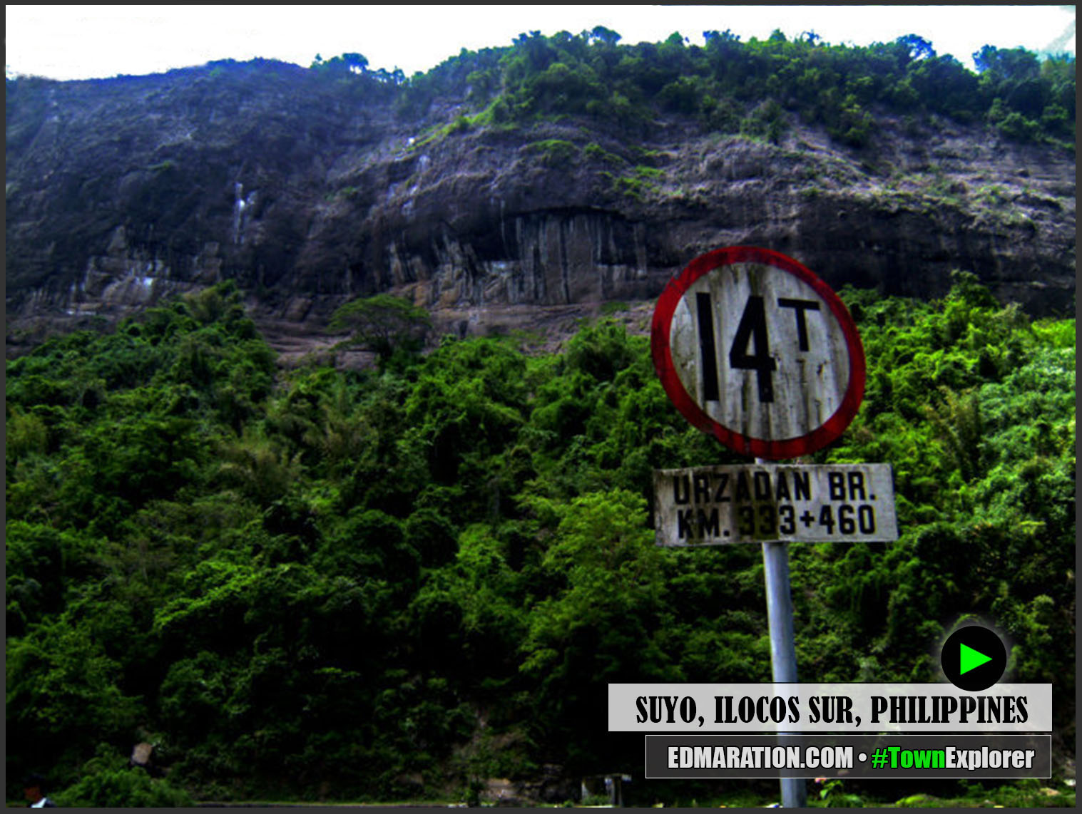
Those huge rocks in the river seemed to cause partial obstruction of the river flow. Speaking of rocks, these river rocks have their queen. As we reached another bridge called the Urzadan bridge, I got mixed emotions to see a huge mountain rock that looked intimidating for a first-time encounter. The gigantic rock faced us straightly as we crossed the curved part of the road!

Urzadan Bridge, Suyo, Ilocos Sur, Ilocos, Luzon Island, Luzon Archipelago, (Philippines), Southeast Asia, Asia, World, Bridges » 16.9832992,120.523083
🇵🇭 SUYO • URZADAN BRIDGE, ONE OF THE BRIDGES ALONG THE SUYO-CERVANTES ROAD.
URZADAN BRIDGE, SUYO, ILOCOS SUR
🇵🇭 SUYO • URZADAN BRIDGE AND THE MONOLITH AT THE BACKGROUND
RIVER IN SUYO, ILOCOS SUR
🇵🇭 SUYO • THE RIVER ROCKS ARE HUGE! CAN YOU SPOT THE RIVER FISHERMAN?
RIVER IN SUYO, ILOCOS SUR
🇵🇭 SUYO • THIS IS THE RIVER THAT FLOWS BELOW THE URZADAN BRIDGE.
RIVER IN SUYO, ILOCOS SUR
🇵🇭 SUYO • THIS RIVER, AS SEEN IN URZADAN, MEETS THE CHICO RIVER IN BRGY KIMPUSA.
I said that I had mixed emotions because the beauty I saw also evoked fear in me, like the thought of a landslide.

We paused our journey with my brother for a while to enjoy the view! The Urzadan bridge met the huge mountain rock in the end.

As our scooter got closer to that gigantic rock, the majesty and grandeur of the rock projected an authority that it's the queen of all the rocks below—bowing down to her royalty.

The gigantic rock was a grand welcome for us—showing a symbolic projection that the town would remain strong amidst both the natural and man-made threats that may come.

RIVER IN SUYO, ILOCOS SUR
🇵🇭 SUYO • THIS IS THE ONLY VEHICLE WE SAW WITHIN THE COURSE OF OUR STOP ON THE URZADAN BRIDGE.
RIVER IN SUYO, ILOCOS SUR
🇵🇭 SUYO • PHOTOGRAPHING THE EDGE OF THE HUGE MOUNTAIN ROCK.
We spent a long time at the Urzadan bridge, and we only saw one vehicle that passed the bridge aside from us. It felt like I was in a national park that was exclusively made for me and my brother.

As we looked down below the bridge, we saw some individuals fishing; and I couldn't decipher where these people came from. Looking around, there were no houses (note: as of 2024, there are already tourist resorts nearby, and a store was built at the end of the bridge). •

— END OF STORY —


• LATEST STORIES COVERING 'SUYO' •

SEE ALL IN A SEPARATE WINDOW
▼ ILOCOS SUR ▼ BRIDGES ▼ INFRASTRUCTURE

 ►  More 'Ilocos Sur' Blogs


MORE STORIES COVERING 'ILOCOS SUR' | SEE OLDER STORIES

 ►  More 'Bridges' Blogs


MORE STORIES COVERING RIVERS | SEE OLDER STORIES

 ►  More 'Infrastructure' Blogs


MORE STORIES COVERING "INFRASTRUCTURE" | SEE OLDER STORIES

MORE TOWNS OR LOCATIONS YOU MIGHT LIKE TO EXPLORE:
B SF C D V B P N C T

UPDATE HISTORY FOR THIS BLOG POST
2024-April-15: This post was rewritten. Lay-out version 2023.12 applied. Photo lay-out version 2024.1 applied.
2011-September-22: Original version of this post published.
NAGUSTUAM DIAY NABASAM/NAKITAM? MABALIN MO MET I-LIKE.