Stories Covering " [Cervantes] "


LATEST TOWN STORIES


Showing posts with label [Cervantes]. Show all posts

Some netizens liked, commented, and shared this. Share your comment. Mag-reply ako once mabasa ko.
Stories of town explorations.
"...no time is wasted, their limited farming fields at the slope of the mountain become productive all year round."

Along the road in the mountain town of Cervantes is an endless mountain scene. At first I was thinking if what are the industries that people are engaging into in this town. I was not even thinking of farming because obviously there are no fertile plains to plant crops.

Maps by Wikipedia
Location Highlighted in Red
But it is not about the fertile plains because the people of Cervantes can really make a way. They are not just making a way, they are also maximizing that "way."

I was at a higher elevation -- a road constructed almost at the top of the mountain so I am able to see this breathtaking encounter from above.

It is  not a Highlighted rice terraces compared with those located in Ifugao. Only a small portion of the mountain was converted into huge green ladders.


At first look you know it is not at all a green huge ladder for rice and at the lower parts, there is deviation.

This mountain farmers are making use of their limited farming space into maximum. So, they plant crops all year round. That's why it is not always rice that is being planted in this small parcel of farming field.

I learned from a friend who hails from Cervantes, Ilocos Sur that during rainy seasons, these mountain farmers plant rice and during summer, they plant vegetables.

And for that matter, no time is wasted, their limited farming fields at the slope of the mountain become productive all year round.

You have just read an article about the mountain farmers, you may want also to read our article about the river farmers. Click here.
Tags: Cervantes, Ilocos Sur | Cervantes, Ilocos Sur Farmers | Vegetable Terraces | Rice Terraces in Ilocos | Rice Terraces in Cervantes
NAGUSTUAM DIAY NABASAM/NAKITAM? MABALIN MO MET I-LIKE.

Some netizens liked, commented, and shared this. Share your comment. Mag-reply ako once mabasa ko.
Stories of town explorations.
"As I am going near up to the mountains, there's no way to say that the road going to the town is deadly because as I saw the view, my senses became alive!."

Why risk your life to a rough road where everywhere is a cliff? As the rain falls down, the rough one-lane road turns into mud and expect land slides. No wonder, years ago, one family perished in this road and 6 of them died as they drop down to a cliff during the night. This is the condition 10 years back.


The mischievous yet breathtaking Cervantes roads
Maps by Wikipedia
Location Highlighted in Red
To begin with, this is the part two (2) of my previous post about our scooter trip to Cervantes entitled "The Great Wall of Ilocos, Reaching Ilocos' Last Frontier via Scooter."
More than a decade ago, there was no well-paved highway and the lovely town becomes isolated most of the time.

However now, thanks to the previous administration of PGMA for funding this highway (The only thing I appreciate about Gloria unless corruption proven) and the highway construction began a decade ago. Before the construction of the multi-billion highway project of Tagudin-Cervantes-Sabangan road and some roads connecting the town to the rest of the Cordilleras, going to Cervantes is not well-recommended, it was a personal choice.

Asking if I went here because of personal choice, no. It was in fact an accident! During the summer of 2010, I and my bro decided just to make a fun road trip.

We were about to cross another province using a scooter, until I decided to take a turn to a new road that took my attention and that is the Tagudin-Cervantes-Sabangan Road.

Taking the less-known road, I really had no idea what to expect in this town but our scooter continues to go (with my bro as the driver). I just stopped talking and although I am nervous, the road trip went on and although I am still undecided if we will pursue the road trip or not to an unknown path, my mouth was frozen to talk about it and my mind just got blunt to decide.

An hour without a decision (and my brother just continues to drive farther while waiting for my decision), is also an hour of many kilometers taken at a speed of not less then 60 kph. The road isn't straight, it was full of curvatures but the speed of our scooter was just optimum to take the empty but curving roads.

Because of the late decision, we have gone far and there's no way of turning back. We were so hungry because there is no human civilization happening to the long stretch of miles we have taken to this unfamiliar and unknown path.

There's no place where we can buy a food, at least water to relieve our thirst until we were able to see a waterfall and drank the water from the falls.

The lush green mountain is carved with a curving road. Can you spot the waterfall here? Take a keen look.
It is not just a landslide, it is a rock slide. Travel at your own risk.
There are road signs and it was my first time to see a road sign with label: 
"Caution Falling Rocks"
In fact, our parents didn't have any idea where we were going this day. We just told them we're going to a pool party in a nearby town but that is just an excuse so that we can go out the house both. Our parents knew that once we were together that early, something they don't want will happen and a scooter ride to a highway isn't their kind of stuff.

Going to Cervantes is like being a contender in the show SURVIVOR, the only difference is that we are the only two in the game not in a beach but in a mountain, and the format conforms - the place in new to us, it is unfamiliar, no water, no store to buy food, no person to cry for help, no gasoline station, with a dangerous environment (e.g. falling rocks) and everything. I think this is more thrilling than any other reality show.


Because the road you are taking is really dangerous and we can just say "deadly," big signage are everywhere to warn travelers. But as I am going near up to the mountains, there's no way to say that the road going to the town is deadly because as I saw the view, my senses became alive! Wow! Such a very beautiful town with snaking roads!

The beauty is very endless. In fact just before the town of Cervantes is the town of Suyo, Ilocos Sur. in the same way, Suyo is lovely and the photos above can attest to that. You just need to take this town first before going to Cervantes using the aforementioned road. We were literally above the clouds and the air gets thinner, the air is getting really freezing cold and we were above the clouds.

Please notice the mountain at the photo above. Can you see the line of trees at the top of the mountain? Well, the part lined with trees is in fact the road we have to take. The experience was beyond compare! Just before we take every road, the mountain at your sight will give you an idea how much effort and resources you are going to spend and gives you a time to decide if you'll going to continue in taking the path or just back out.

In Cervantes, Ilocos Sur, pine trees abound. When we were so tired with my bro, I had the chance to lay down to the road blocks that goes directly to the cliff together with the pine trees and the clean cool air.

Dare to take that Road? Taking that path is a way to reach Cervantes.
Finally, after taking the deadly road as shown above, we were able to reach the valley where the civilization now occurs.

 At the town center is a market, college, hospital, school, the town hall, and there you are, carinderia! We reached the town center for fun and beyond expectation! Now, would you dare to take the deadly road? But I think it is better to go this way, "Are you willing to see the beautiful town?"

Then if yes, you must take the deadly road because along the road to Cervantes is where you can find the real thrill of traveling to Cervantes. The trail was challenging but reaching  and seeing the beauty of an exceptional town is already a good reward that is more than enough.

Tags: Cervantes, Ilocos Sur | Cervantes, Ilocos Sur Adventure | Motorcycle Ride to Cervantes, Ilocos Sur | Cervantes, Ilocos Sur Highway | Cervantes, Ilocos Sur Road | Tagudin-Cervantes-Sabangan Road | Tagudin-Cervantes-Sabanga Highway |Road Trip to Cervantes
NAGUSTUAM DIAY NABASAM/NAKITAM? MABALIN MO MET I-LIKE.

Some netizens liked, commented, and shared this. Share your comment. Mag-reply ako once mabasa ko.
Stories of town explorations.
It was a never ending nervousness with the question of "What will happen to me next?" as I continue traversing more and more mountains with no idea where will I end up or if I will go back home safe and alive."

I am chilling with the coldness of the fresh air until my jaw is dropping with awe with the majestic and iconic view I am looking at. The feeling is like I was outside the Philippines on which I never expected that the Philippines has done this project - a highway curved at the cliffs and at the steep rocky slopes of the mountain almost 90 degrees in angle. I was speechless!


I have never seen the Great Wall of China personally and in an actual manner but because of the fame of that structure, I often see pictures of it everywhere.

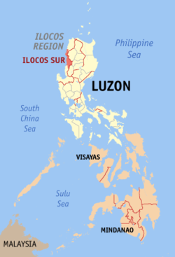
As I was traversing the Tagudin-Cervantes-Sabangan Road, a highway system connecting Ilocos Sur to Benguet and Mountain Province, my heart was beating so fast as I was going up the mountains using a single motor ride. I was below and I can see the peak of the mountain.

Unexpectedly, I thought I'll be going the other way but the road I am taking was actually leading me to the peak of that mountain I used to see below!

I never thought that the peak of that mountain is flat and there is a highway placed therein. It was just phenomenal!

I reached the peak of the mountain but it wasn't yet the dead end because after the peak of that mountain, there is another mountain, higher, smarter and more mysterious.

You don't know what will happen to you next because you're the only one riding in that empty road, no traffic at all, no houses, no people, just you and the trees, the fog that covers your way and the mysterious sounds of nature that you don't even know where it is coming from.

What is exciting is, the road I was with will gradually wind up to that next mountain, higher and more mystical!

My backpack overlooking another mountain and believe it or not, the highway winds at the top of the mountain and will lead you further to the mountain at the background.
I was able to reach the top of that mountain but as I am few feet away to the top, I can see another side of the paradise. It is another mountain to take and at the farther distance of my sight is another mountain range aside from the first which I will be taking using a motor ride.

This is my official entry to the PTB Blog Carnival for
December 2011 hosted by Kara Santos of  Traveling Up
with the theme, "The Journey is the Destination."
No houses, no gasoline station. It feels like it is the point of no return. It was mixed emotions of awe and nervousness. I was elated to see a view.

Great Wall of China never came to my mind at the actual place but when I uploaded it on the computer, it seemed like the great wall of China. My eyes bulged with an unexpected beauty and wonder Ilocos Sur can offer.

Two contravening emotions are gliding in my mind that day, the feeling of achievement and the feeling of hesitation. It was an achievement because I was able to cross the highest point of any highway system in Ilocos Region and the feeling of hesitation if I'll be able to go back home safe and alive.

Being a newbie in that place without any idea what will I except, I didn't know if I will continue my journey or not because more and more mountains to cross are appearing as I am done with the latter.

I was already about 40 kilometers away from the main road [Maharlika Highway] and if I'll go back, my effort will be useless because I didn't pursue my goal to reach the highest and last frontier of the Ilocos Sur province - the town of Cervantes.

However at the back of my mind is full of hesitation because as I go up those winding roads all curved in a cliff, they become more mysterious on which I didn't know what to expect if I'll purse the journey.

Landslides, New People's Army member, falling rocks, mysterious man-eating creatures, cannibals, war freak tribes and the like are the things playing in my mind that would serve as a threat in my adventurous life or traveling and discovering... and blogging too.

The roads are well-paved and the setting is undeniably a paradise but of course it can not be pulled out in my mind the possible threats I will be facing while taking a place new to me, up in the mountains with no person to cry for help, no house to ask for shelter and no other place to hide and escape except from jumping into the cliff down to the rushing river and rapids. It was a make or break. I was using a motor ride and if my ride will have trouble, no one will help me.

The air was so cold, the fog is starting to cover the place with a frightening sound on which I didn't know where it was coming from.

It takes a lot of effort, courage and determination to reach the last frontier called the town of Cervantes in Ilocos Sur isolated from the lowland civilization and hidden by the protective walls of the mountains now being reached by a multi-billion highway project that serves as a replica of the Great Wall in China.

It was a never ending nervousness with the question of "What will happen to me next?" as I continue traversing more and more mountains with no idea where will I end up.


I was already midway of the goal I guess and midway of a decision if I will continue or not. I still had the time to think about it because it is already getting late, the breeze getting colder, the mysterious howling sounds are becoming louder and I am going higher to the clouds.

To alleviate the tension of fear, I sat back, took a look and taken some photographs of the paradise I am seeing that time to at least relieve the stress of fear, hesitation and doubt.

I was impressed and I realized that I need to pursue my journey because I believe that greater reward of traveling is awaiting me at the end. That was my faith and I kept holding to my faith.

As I was going on my way, another high mountain is weaving a sound discouragement that I can not make it because that mountain is more steep, higher and farther. But I kept my determination fixed. I continued the journey!

Come what may but I need to do the thing and pursue to the goal!


I did it! I was able to reach Ilocos Sur's last frontier, the easternmost town of the province located up high the mountains being an isolated town for years. The experience was more than fulfilling!

The beauty of the place and the experience replenished my soul because of a great awe primarily to the Lord who was the Architect of these wonders of nature!


I reached the last frontier and I was glad, I was able to see the Great Wall of China in my own homeland. There is nothing I can ask for more! It was not all about the destination per se but it was the experience that I had that is truly unforgettable. The experience while traveling is already the destination indeed! /end


Related posts filed under the category "BLOG CARNIVAL"

Traveling 4 provinces in PhP3,500 (for 3days and 2 nights)When a Nurse Travels | The Life-Changing MomentsEdmaration.com | The Travel Blog that Started with a Motobike JoyrideThe Birth of 29 Travel Blogs | The Journey that Made Us a Travel BloggerTop 12 in 2012 | A Year-End Post About 12 BeginningsBlog Carnival: Where do Broken Hearts Go? (A Traveler's Perspective)Philippine Summer: A Season for Town Exploration
NAGUSTUAM DIAY NABASAM/NAKITAM? MABALIN MO MET I-LIKE.

Some netizens liked, commented, and shared this. Share your comment. Mag-reply ako once mabasa ko.
Stories of town explorations.
"I came here under the scorching heat of the sun in the extended summer for June but reaching the place seems like it is already December..."

If you'll give me a chance to describe Bessang Pass in four words, I would choose FOG, CHILL, HISTORY and FOG again. Being here feels like I am with the clouds in the sky. It is such a paradise behind the clouds up high. Imagine, I came here under the scorching heat of the sun in the extended summer for June but reaching the place seems like it is already December because aside from the fog which is everywhere, the place is also chilly to the point that I need to wear jacket not to cover my skin from the harmful rays of the summer sun but to provide heat to my trembling body.
 

Foggy Bessang Pass


Bessang Pass is the highest point to any road/highway system in Ilocos Sur [and probably in Ilocos region as a whole]. Located 260 kilometers away from Manila, Bessang Pass is situated at a strategic point in the town of Cervantes in Ilocos Sur Province, Philippines.

Great Mountains


Vanishing Highway


Maps by Wikipedia
Location Highlighted in Red
In fact, Bessang Pass does not only offer a piece of nature's beauty but it is also a part of the Philippine History.

Maybe you have heard the Battle of Bessang Pass? That event happened here exactly. According to our written history, Bessang Pass was the last stronghold of the Japanese imperial forces under Gen. Tomoyuki Yamashita, known as the “Tiger of Malaya” and conqueror of Singapore.

It was part of the triangular defense of General Yamashita in the north, namely the Balete Pass, Villaverde Trail and Bessang Pass, guarding the Ifugao-Benguet-Vizcaya borders.

Its fall on the hands of the United States Armed Forces in the Philippines (USAFP-NL) on June 14, 1945 paved the way to the entrapment of Yamashita’s forces in the Cordillera until the general’s surrender in September 1945. The battle was the crowning glory of the battle exploits of the all-Filipino USAFP-NL forces. The battle lasted for four months of protracted, fierce, relentless blood hand to hand combat with suicidal enemy.

Mountain top


Because of that history that has been written in books and its rule for shaping the independence of our country Philippines, a marker has been put up in commemoration of the Battle of Bessang Pass where we were sitting with my bro. 30 minutes away from this pass is the Cervantes town center and more hours of travel will lead you to either, Benguet or Mountain Province and soon Abra.

As I was telling, everywhere is fog. In Bessang Pass, there is also a park called Bessang Pass National Park where there are some facilities to have a chilly picnic and behind that park is a cliff and the amazing thing is you can not see that cliff because at your background is all fog.

Before reaching Bessang Pass, a lot of waterfalls just along the highway will welcome you. Some waterfalls even fall just directly to the road making it slippery. So if you're planning to visit Bessang Pass, be sure to fasten your sit belt. You're ultimate fear would be the falling rock, landslide and the fog but don't worry, there is a low and almost no accident record in this highway because it is not a busy highway. Of course, it always helps to be careful and cautious anytime.

Regarding the falling rocks, it is not so common but of course road signs will always remind you as well as the landslide prone areas. It is just a reminder to be careful and not to intimidate travelers.

With my bro at the Battle of Bessang Pass Marker


The mountainous background becomes white!


Battle of Bessang Pass Marker


Beautiful Cervantes Mountains


I have mentioned that Bessang Pass is 260 km away from Manila but we have gone too far, as far as 355 km away from Manila still in the mountains. Well, that would be another story.

NAGUSTUAM DIAY NABASAM/NAKITAM? MABALIN MO MET I-LIKE.